
Maps to get you to Fethard on Sea
Website
office(Wexford)
John Dier
Wednesday 30th March
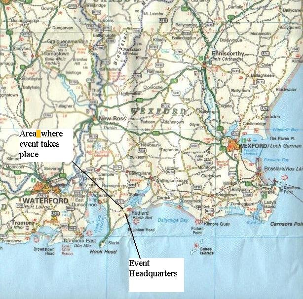
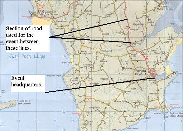
As you can see we have posted two maps that show the general area and a more detailed map of the local area round Fethard on Sea. Just in case people may have difficulties in following the maps, we have included the following instructions.
The area where the hill climb will be held is an easy area to get from all routes. For overseas competitors who arrive in Rosslare Hbr, take the following route. Follow the N25(sign posted Dublin,Cork etc) to the first roundabout that you meet approx 10miles from the port. Take the first exit here following the N25. At the second roundabout, take the first exit on the R733, sign posted, Duncannon. Follow this road for approx 15miles, through Wellingtonbridge(at this stage you will also see the road signed with "Ring of Hook drive". Keep on following this road until you see signs for the R734.(New Ross to the right and Fethard to the left). This will bring you straight into Fethard village where you will see the Hotel on the right, which is the HQ. Bear in mind that during the event itself, part of this road will be closed for the event. Turning at that crossroad will bring you to the top of the hill. To get to the bottom of the hill, take the turn before that,signed "Saltmills".
Anyone travelling from the Midlands and South will come to New Ross. As you leave the town on the N25(heading for Wexford), take the road to the right(R734) all the way to Fethard. The road will also be signed for Campile.
People travelling from the North and Dublin will come on the N11. After you cross the River Slaney at Ferrycarrig, go straight at the first roundabout and take the third exit at the next roundabout(R733 for Duncannon) and follow the instructions above along the R733.
Hopefully this is of some help and we will see you there.
JD
How to get to Fethard on Sea
Close-up map of the event area
JD